Harrison Avenue Bridge See also References External links Navigation menu41°24′N 75°42′W / 41.4°N 75.7°W / 41.4; -75.741°24′N 75°42′W / 41.4°N 75.7°W / 41.4; -75.741°24′0″N 75°39′5″W / 41.40000°N 75.65139°W / 41.40000; -75.6513941°24′0″N 75°39′5″W / 41.40000°N 75.65139°W / 41.40000; -75.65139Highway Bridges Owned by the Commonwealth of Pennsylvania, Department of Transportation TR88000767"National Register Information System""Harrison Avenue Bridge""Harrison Avenue Bridge Project To Start Monday""New Harrison Avenue Bridge Opens in Scranton""Old Harrison Avenue Bridge Demolished in Explosion"Harrison Avenue BridgeAnthracite Bridge CompanyAbraham Burton CohenHarrison Avenue Bridge
Bridges completed in 1922Road bridges on the National Register of Historic Places in PennsylvaniaBuildings and structures in Scranton, PennsylvaniaBridges in Lackawanna County, PennsylvaniaRoad bridges in PennsylvaniaHistoric American Engineering Record in PennsylvaniaNational Register of Historic Places in Lackawanna County, PennsylvaniaConcrete bridges in the United StatesOpen-spandrel deck arch bridges in the United States1922 establishments in Pennsylvania
deck arch bridgeScranton, PennsylvaniaUnited StatesRoaring BrookLackawanna and Wyoming Valley RailroadCentral Scranton ExpresswayDelaware, Lackawanna and Western Railroadheritage railroadSteamtown National Historic SiteProgressive EraNew York CityAbraham Burton CohenNational Register of Historic Places![]() Harrison Avenue Bridge
Harrison Avenue Bridge
Harrison Avenue Bridge | |
|---|---|
 The Harrison Avenue Bridge in March 2015, with the Central Scranton Expressway under the right-most arch. | |
| Coordinates | 41°24′N 75°42′W / 41.4°N 75.7°W / 41.4; -75.7Coordinates: 41°24′N 75°42′W / 41.4°N 75.7°W / 41.4; -75.7 |
| Carries | Harrison Avenue (State Route 6011) |
| Crosses | Roaring Brook and Central Scranton Expressway |
| Locale | Scranton, Pennsylvania |
| Other name(s) | South-East Scranton Viaduct |
| Maintained by | PennDOT |
| Characteristics | |
| Design | Open-spandrel deck arch |
| Material | Concrete |
| Total length | 407 feet (124 m) |
| Width | 40 feet (12 m) |
| Longest span | 202 feet (62 m) |
No. of spans | 3 |
| History | |
| Designer | Abraham Burton Cohen |
| Constructed by | Anthracite Bridge Company |
Harrison Avenue Bridge | |
U.S. National Register of Historic Places | |
 The Harrison Avenue Bridge in 1999. | |
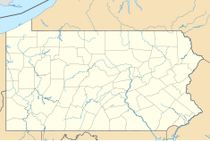
 Location in Pennsylvania | |
| Coordinates | 41°24′0″N 75°39′5″W / 41.40000°N 75.65139°W / 41.40000; -75.65139Coordinates: 41°24′0″N 75°39′5″W / 41.40000°N 75.65139°W / 41.40000; -75.65139 |
| Area | less than one acre |
| Built | 1922 |
| MPS | Highway Bridges Owned by the Commonwealth of Pennsylvania, Department of Transportation TR |
| NRHP reference # | 88000767[1] |
| Added to NRHP | June 22, 1988 |
Harrison Avenue Bridge was a concrete deck arch bridge carrying Harrison Avenue (unsigned SR 6011) in Scranton, Pennsylvania, United States. Its three spans included an open-spandrel ribbed arch over Roaring Brook, flanked by two closed-spandrel arches. The southwestern closed-spandrel arch spanned the former Lackawanna and Wyoming Valley Railroad (Laurel Line), converted to highway use in 1964 as the Central Scranton Expressway.[2] The northeastern closed-spandrel arch spans the former Delaware, Lackawanna and Western Railroad, now a heritage railroad operated by Steamtown National Historic Site.
Built in 1921-1922, the bridge was notable as an example of Progressive Era civic involvement, its construction having been promoted by a citizens' group called the South to East Scranton Bridge Association. It was designed by New York City-based consulting engineer Abraham Burton Cohen, although Scranton Department of Public Works chief engineer William A. Schunk and his assistant Charles F. Schroeder were more actively involved in day-to-day supervision of construction.[3] The bridge was listed on the National Register of Historic Places in 1988.
Construction of a replacement bridge on a parallel alignment began in October 2014 and was completed in December 2017.[4][5] The old bridge was demolished in June 2018.[6]
See also
- List of bridges documented by the Historic American Engineering Record in Pennsylvania
- List of bridges on the National Register of Historic Places in Pennsylvania
- National Register of Historic Places listings in Lackawanna County, Pennsylvania
References
^ National Park Service (2010-07-09). "National Register Information System". National Register of Historic Places. National Park Service..mw-parser-output cite.citationfont-style:inherit.mw-parser-output .citation qquotes:"""""""'""'".mw-parser-output .citation .cs1-lock-free abackground:url("//upload.wikimedia.org/wikipedia/commons/thumb/6/65/Lock-green.svg/9px-Lock-green.svg.png")no-repeat;background-position:right .1em center.mw-parser-output .citation .cs1-lock-limited a,.mw-parser-output .citation .cs1-lock-registration abackground:url("//upload.wikimedia.org/wikipedia/commons/thumb/d/d6/Lock-gray-alt-2.svg/9px-Lock-gray-alt-2.svg.png")no-repeat;background-position:right .1em center.mw-parser-output .citation .cs1-lock-subscription abackground:url("//upload.wikimedia.org/wikipedia/commons/thumb/a/aa/Lock-red-alt-2.svg/9px-Lock-red-alt-2.svg.png")no-repeat;background-position:right .1em center.mw-parser-output .cs1-subscription,.mw-parser-output .cs1-registrationcolor:#555.mw-parser-output .cs1-subscription span,.mw-parser-output .cs1-registration spanborder-bottom:1px dotted;cursor:help.mw-parser-output .cs1-ws-icon abackground:url("//upload.wikimedia.org/wikipedia/commons/thumb/4/4c/Wikisource-logo.svg/12px-Wikisource-logo.svg.png")no-repeat;background-position:right .1em center.mw-parser-output code.cs1-codecolor:inherit;background:inherit;border:inherit;padding:inherit.mw-parser-output .cs1-hidden-errordisplay:none;font-size:100%.mw-parser-output .cs1-visible-errorfont-size:100%.mw-parser-output .cs1-maintdisplay:none;color:#33aa33;margin-left:0.3em.mw-parser-output .cs1-subscription,.mw-parser-output .cs1-registration,.mw-parser-output .cs1-formatfont-size:95%.mw-parser-output .cs1-kern-left,.mw-parser-output .cs1-kern-wl-leftpadding-left:0.2em.mw-parser-output .cs1-kern-right,.mw-parser-output .cs1-kern-wl-rightpadding-right:0.2em
^ Henwood, James N. J.; Muncie, John G. (1986). Laurel Line: An Anthracite Region Railway. Glendale, CA: Interurban Press; reprint, Eynon, PA: Tribute Books, 2005. p. 186. ISBN 0976507234.
^ Spivey, Justin M. (August 1998). "Harrison Avenue Bridge" (PDF). Historic American Engineering Record. Washington, D.C.: Library of Congress. pp. 10–11. Retrieved November 27, 2017.
^ Lange, Stacy (October 21, 2014). "Harrison Avenue Bridge Project To Start Monday". WNEP. Retrieved June 23, 2018.
^ Lange, Stacy (December 8, 2017). "New Harrison Avenue Bridge Opens in Scranton". WNEP. Retrieved June 23, 2018.
^ Blackburne, Carolyn (June 5, 2018). "Old Harrison Avenue Bridge Demolished in Explosion". WNEP. Retrieved June 23, 2018.
External links
![]() Media related to Harrison Avenue Bridge at Wikimedia Commons
Media related to Harrison Avenue Bridge at Wikimedia Commons
Historic American Engineering Record (HAER) No. PA-498, "Harrison Avenue Bridge", 7 photos, 17 data pages, 1 photo caption page
Anthracite Bridge Company information at Structurae
Abraham Burton Cohen at Structurae
Harrison Avenue Bridge at Structurae