Khovd (city) Contents Geography and climate Population See also References Navigation menu48°00′15″N 91°38′26″E / 48.00417°N 91.64056°E / 48.00417; 91.6405648°00′15″N 91°38′26″E / 48.00417°N 91.64056°E / 48.00417; 91.64056"Khovd Climate Normals 1973-1990"Khovd Aimag Statistical Office 2007 Annual Report"Feasibility Assessment of Sustainable Use of Land and Water in the Buyant River Delta, Khovd Aimag"the originalee
AltaiBulganBuyantChandmaniDarviDörgönDuutErdenebürenJargalant (Khovd city)KhovdMankhanMönkhkhairkhanMöstMyangadTsetsegÜyenchZeregChoirGovisümberMandalgoviDundgoviDalanzadgadÖmnögoviBaruun-UrtSükhbaatarSainshandDornogoviAltaiGovi-AltaiBulganBulganÖndörkhaanKhentiiChoibalsanDornodUlaangomUvsUliastaiZavkhanErdenetOrkhonBayankhongorBayankhongorZuunmodTövKhovdKhovdDarkhanDarkhan-UulTsetserlegArkhangaiÖlgiiBayan-ÖlgiiSükhbaatarSelengeArvaikheerÖvörkhangaiMörönKhövsgöl
Aimag centersDistricts of Khovd ProvincePopulated places established in the 17th century
MongolianKhovd ProvinceMongoliaAltay MountainsBuyant RiverKhar-Us LakeJargalantsumdesert climateKöppen climate classificationUuldKhalkhZakhchinTorguudUriankhaiMyangadBayadKazakÜzemchin
Coordinates: 48°00′15″N 91°38′26″E / 48.00417°N 91.64056°E / 48.00417; 91.64056
Khovd Ховд .mw-parser-output .font-mongfont-family:"Menk Hawang Tig","Menk Qagan Tig","Menk Garqag Tig","Menk Har_a Tig","Menk Scnin Tig","Oyun Gurban Ulus Tig","Oyun Qagan Tig","Oyun Garqag Tig","Oyun Har_a Tig","Oyun Scnin Tig","Oyun Agula Tig","Mongolian Baiti","Noto Sans Mongolian","Mongolian Universal White","Mongol Usug","Mongolian White","MongolianScript","Code2000","Menksoft Qagan".mw-parser-output .font-mong-mnc,.mw-parser-output .font-mong:lang(mnc-Mong),.mw-parser-output .font-mong:lang(dta-Mong),.mw-parser-output .font-mong:lang(sjo-Mong)font-family:"Abkai Xanyan","Abkai Xanyan LA","Abkai Xanyan VT","Abkai Xanyan XX","Abkai Xanyan SC","Abkai Buleku","Daicing White","Mongolian Baiti","Noto Sans Mongolian","Mongolian Universal White" ᠬᠣᠪᠳᠤ | |
|---|---|
 The city of Khovd | |
 Khovd | |
| Coordinates: 48°00′15″N 91°38′26″E / 48.00417°N 91.64056°E / 48.00417; 91.64056 | |
| Country | Mongolia |
| Province | Khovd Province |
| Founded | 1731 |
| Area | |
| • Total | 70.0 km2 (27.0 sq mi) |
| Elevation | 1,395 m (4,577 ft) |
| Population (2017) | |
| • Total | 29,800 |
| • Density | 430/km2 (1,100/sq mi) |
| Time zone | UTC+7 (UTC + 7) |
| Area code(s) | +976 (0)143 |
| Climate | BWk |
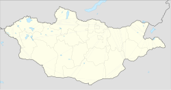
Khovd or Hovd (Mongolian: Ховд), formerly known as Kobdo or Khobdo, is the capital of the Khovd Province of Mongolia. Officially known as Jargalant sum.
Contents
1 Geography and climate
2 Population
3 See also
4 References
Geography and climate

Street in Khovd

Khovd downtown
It is situated at the foot of the Mongol Altay Mountains, on the Buyant River. The Khar-Us Lake is located approximately 25 km east of Khovd, and is the location of a Strictly Protected Area (Mongolian Government designation), called the Mankhan Nature Preserve.[citation needed]
As a result of administrative reforms in 1992, Khovd was accorded the status of Jargalant sum. City area is 80 km2.
Khovd has a cold desert climate (Köppen climate classification BWk) with long, dry, frigid winters and short warm summers. Precipitation is minimal and very heavily concentrated in summer.
| Climate data for Khovd | |||||||||||||
|---|---|---|---|---|---|---|---|---|---|---|---|---|---|
| Month | Jan | Feb | Mar | Apr | May | Jun | Jul | Aug | Sep | Oct | Nov | Dec | Year |
| Record high °C (°F) | 8.7 (47.7) | 13.6 (56.5) | 21.7 (71.1) | 30.7 (87.3) | 32.0 (89.6) | 34.2 (93.6) | 33.4 (92.1) | 35.6 (96.1) | 30.0 (86.0) | 24.7 (76.5) | 14.4 (57.9) | 13.3 (55.9) | 35.6 (96.1) |
| Average high °C (°F) | −16.3 (2.7) | −12 (10) | 0.3 (32.5) | 11.1 (52.0) | 19.1 (66.4) | 23.8 (74.8) | 24.7 (76.5) | 23.4 (74.1) | 17.7 (63.9) | 9.0 (48.2) | −2.3 (27.9) | −12.9 (8.8) | 7.1 (44.8) |
| Daily mean °C (°F) | −24.3 (−11.7) | −20.2 (−4.4) | −7.4 (18.7) | 3.9 (39.0) | 11.9 (53.4) | 17.1 (62.8) | 18.6 (65.5) | 16.7 (62.1) | 10.6 (51.1) | 1.5 (34.7) | −9.7 (14.5) | −20 (−4) | −0.1 (31.8) |
| Average low °C (°F) | −29.9 (−21.8) | −27.1 (−16.8) | −14.7 (5.5) | −3.5 (25.7) | 4.6 (40.3) | 10.3 (50.5) | 12.3 (54.1) | 10.0 (50.0) | 3.9 (39.0) | −4.7 (23.5) | −15.7 (3.7) | −25.6 (−14.1) | −6.7 (19.9) |
| Record low °C (°F) | −46.6 (−51.9) | −44.6 (−48.3) | −31.7 (−25.1) | −19.7 (−3.5) | −8.6 (16.5) | −6.4 (20.5) | 1.5 (34.7) | −0.9 (30.4) | −13.9 (7.0) | −25.3 (−13.5) | −35.2 (−31.4) | −40.4 (−40.7) | −46.6 (−51.9) |
| Average precipitation mm (inches) | 1.4 (0.06) | 0.9 (0.04) | 2.3 (0.09) | 5.9 (0.23) | 9.5 (0.37) | 26.5 (1.04) | 35.0 (1.38) | 22.7 (0.89) | 10.6 (0.42) | 4.6 (0.18) | 1.8 (0.07) | 1.6 (0.06) | 122.8 (4.83) |
| Average precipitation days (≥ 1.0 mm) | 0.3 | 0.2 | 0.6 | 1.4 | 2.4 | 3.9 | 6.2 | 4.0 | 1.9 | 0.8 | 0.4 | 0.5 | 22.6 |
| Mean monthly sunshine hours | 171.6 | 196.3 | 255.2 | 266.8 | 300.4 | 300.1 | 302.1 | 298.0 | 269.7 | 230.9 | 180.3 | 151.0 | 2,922.4 |
| Source: NOAA (1961-1990) [1] | |||||||||||||
Population
The city has a population of 26,023 (2000 census), 30,479 (2003, est.), 28,601(2007[2]).
In 2005, Jargalant sum (the centre of Khovd Aimag) had 32,351 inhabitants (6,675 households), belonging to more than ten ethnic groups and nationalities such as Uuld, Khalkh, Zakhchin, Torguud, Uriankhai, Myangad, Durvud, Bayad, Kazak, Chantuu and Üzemchin.[3]
See also
- Sangiin Kerem
References
^ "Khovd Climate Normals 1973-1990". National Oceanic and Atmospheric Administration. Retrieved January 13, 2013..mw-parser-output cite.citationfont-style:inherit.mw-parser-output .citation qquotes:"""""""'""'".mw-parser-output .citation .cs1-lock-free abackground:url("//upload.wikimedia.org/wikipedia/commons/thumb/6/65/Lock-green.svg/9px-Lock-green.svg.png")no-repeat;background-position:right .1em center.mw-parser-output .citation .cs1-lock-limited a,.mw-parser-output .citation .cs1-lock-registration abackground:url("//upload.wikimedia.org/wikipedia/commons/thumb/d/d6/Lock-gray-alt-2.svg/9px-Lock-gray-alt-2.svg.png")no-repeat;background-position:right .1em center.mw-parser-output .citation .cs1-lock-subscription abackground:url("//upload.wikimedia.org/wikipedia/commons/thumb/a/aa/Lock-red-alt-2.svg/9px-Lock-red-alt-2.svg.png")no-repeat;background-position:right .1em center.mw-parser-output .cs1-subscription,.mw-parser-output .cs1-registrationcolor:#555.mw-parser-output .cs1-subscription span,.mw-parser-output .cs1-registration spanborder-bottom:1px dotted;cursor:help.mw-parser-output .cs1-ws-icon abackground:url("//upload.wikimedia.org/wikipedia/commons/thumb/4/4c/Wikisource-logo.svg/12px-Wikisource-logo.svg.png")no-repeat;background-position:right .1em center.mw-parser-output code.cs1-codecolor:inherit;background:inherit;border:inherit;padding:inherit.mw-parser-output .cs1-hidden-errordisplay:none;font-size:100%.mw-parser-output .cs1-visible-errorfont-size:100%.mw-parser-output .cs1-maintdisplay:none;color:#33aa33;margin-left:0.3em.mw-parser-output .cs1-subscription,.mw-parser-output .cs1-registration,.mw-parser-output .cs1-formatfont-size:95%.mw-parser-output .cs1-kern-left,.mw-parser-output .cs1-kern-wl-leftpadding-left:0.2em.mw-parser-output .cs1-kern-right,.mw-parser-output .cs1-kern-wl-rightpadding-right:0.2em
^ Khovd Aimag Statistical Office 2007 Annual Report
^ Dr Jörg Janzen (2006). "Feasibility Assessment of Sustainable Use of Land and Water in the Buyant River Delta, Khovd Aimag" (PDF). National University of Mongolia. p. 138. Archived from the original (PDF) on 22 August 2007.
| Wikivoyage has a travel guide for Hovd. |
